Can U.S. Cities Compensate for Curbing Sprawl by Growing Denser?

Key Takeaways:
The link between housing production and outward expansion is unmistakable: cities that expand more produce proportionally more new housing.
Throughout the country, housing production is skewed towards low density areas.
Densification has slowed down across the board, and especially in expensive cities, undermining their ability to compensate for less outward expansion.
Unless they enact fundamental changes that allow for substantially more densification, cities confronting growth pressure face a tradeoff between accommodating growth through outward expansion, or accepting the social implications of failing to build enough new housing.
The U.S. population is projected to continue growing for decades to come, reaching 400 million circa 2050. Accommodating more people at current living standards will require many new homes, but how will cities deliver such housing? Must they continue expanding outward to provide enough housing, as they have done historically, or will densification within the existing footprint do the trick?
To those who value urbanism and feel strongly against sprawl – as does this author – the answer may seem self-evident at first. Of course cities should favor densification over the ills of sprawl. But if the past is any guide to the future, failing to expand cities will come at a cost. Cities that have curbed their expansion have – with limited exception – failed to compensate with densification. As a result they have produced far less housing than they would otherwise, with severe national implications for housing affordability, geographic mobility and access to opportunity, all of which are keenly felt today as we approach the top of another housing cycle.
This study extends an earlier one entitled “Has the Expansion of American Cities Slowed Down?” which created a new framework for consistently measuring the historic area of cities’ developed footprint, and showed that while the expansion of certain expensive U.S. cities is slower than it used to be, others are expanding with gusto. In contrast, the current study examines cities’ housing production within the developed footprint. It documents that housing production is proportional to outward expansion, and helps explain the fact with two observations: first, that new home construction is skewed towards low density areas and, second, that in recent decades densification has grown much less common, particularly in those cities whose expansion has slowed down the most.
Both studies use the age of existing residential structures in the U.S. drawn from the American Community Survey to track the number of homes built each decade in every Census block group – a set of fine-grained areas that span the entire country. The main shortcoming of the method is that it suffers from demolition bias: homes demolished in the past do not appear in current data.[1] However, the alternative of using historic data is not viable, because such data do not offer the geographic granularity necessary to recreate cities’ past developed footprints or observe local housing densities. Whenever possible, historic data at the county level from 1970 onwards, which shows the number of homes observed at the time, is used to account for demolition bias. The impact of demolition bias in those cases is limited, suggesting the same elsewhere. A full account of the methods used, including their shortcomings, is provided in the methodology section.
The Link Between U.S. Cities’ Housing Production And Their Outward Expansion Is Unmistakable
Let’s start with an example. The cities of San Diego and Phoenix developed very similarly from 1950 to 1980. However as the chart below illustrates, their paths diverged after 1980 when San Diego’s growth slowed down while Phoenix’s picked up.

In both San Diego and Phoenix, the close relationship between the size of the developed land area and the number of homes is no coincidence (once demolition bias is accounting for the relationship is even closer). In fact, it is generally the case that U.S. cities’ produce new housing in proportion to their rate of outward expansion. The next chart demonstrates the relationship between housing production and outward expansion across all U.S. cities with population over 250,000 residents, and it is unmistakable.[2]

Going a step further, when cities change their pace of outward expansion, their rate of housing production tends to change accordingly. The following chart considers two 30 year periods – 1950 to 1980 and 1980 to 2010 – and plots the change between the periods in the number of new homes built, against the change between the periods in the extent of outward expansion. This chart, too, exhibits a clear relationship. Greater increases (and decreases) in cities’ pace of outward expansion coincide, on average, with proportionally greater increases (and decreases) in their rate of housing production.

In the earlier study I labeled U.S. cities as either expensive, expansive – with an a – or as legacy cities. Both expensive and expansive cities are economically vibrant and face pressure to grow, but whereas expansive cities like Atlanta, Houston and Phoenix continually provide ample new housing at affordable prices, expensive cities like San Francisco, New York and San Diego do not. Since the 1970s, expensive cities have failed to produce enough new homes to keep real housing costs steady, and as a result they have curbed their population growth and sent real housing prices on a long-run upward spiral. Legacy cities are ones whose economic power has faded, and no longer generate population growth or housing price growth.
Expansive cities are easy to identify in the chart. They pervade the upper-right quadrant, showing both an increased rate of outward expansion and of housing production. Expensive and legacy cities, on the other hand, are jointly clustered near the origin and in the lower-left quadrant. They can be distinguished by their colors, which correspond to the real changes in cities’ housing prices from 1980 to 2010. A housing stock that cannot accommodate demand has driven up housing prices in expensive cities, rendering them red, whereas legacy cities show up alongside the expensive ones in cool shades of blue. There, the demand for housing is stagnant and easily accommodated by the existing stock, resulting in modest (if any) increase in the real cost of housing.
Not all cities fall into the upper-right and lower-left quadrants. Some are clearly located in the upper-left quadrant, indicating that they have increased the rate of housing production without increasing the pace of outward expansion, or even while slowing it down. Portland and Seattle are good examples. But such cities send an ambiguous message. On one hand, they offer encouraging evidence that cities can undergo meaningful densification while curbing their outward expansion. On the other hand, they have failed to avoid escalating housing costs – as indicated by their color. Moreover, the increase in such cities’ rate of housing production pales in comparison to what similarly-sized cities like Phoenix and Atlanta have achieved through outward expansion.
Why does housing production correspond so closely with outward expansion? There can be many possible reasons, but two of them stand out as particularly important:
Undeveloped and low density areas produce a disproportionately large share of cities’ new housing. Restricting the flow of undeveloped land “into” a city chokes off subsequent rounds of densification, because low density areas add new housing more readily than denser ones.
Cities which curb their outward expansion are also likely to curb densification within the existing footprint, e.g. through more restrictive land use policy.
Throughout the country, housing production is skewed towards low density areas
The density of stereotypical suburbia is around 4 homes per acre. Densities up to about 10 homes per acre are still suburban in nature, consisting of low-rise development that often features single family homes, just packed more tightly than the stereotype. The following images illustrate these densities. In what follows, I refer to areas with a housing density below 4 homes per acre – including undeveloped areas – as low density areas.


From left to right: roughly one home per acre in Edinburg, NJ; roughly 4 homes per acre in Boulder, CO; roughly 10 homes per acre in Los Angeles, CA. Examples drawn from the Lincoln Land Institute’s Visualizing Density gallery.
Housing production in the U.S. is overwhelmingly concentrated in low density areas. As the rightmost bar in the right hand chart shows, 23.3 percent of new homes in the 2000s were built in undeveloped areas, another 33.2 percent in developed areas with a prior density below 1 home per acre, and yet another 31.9 percent in areas with a prior density between 1 and 4 homes per acre. In total, 88.4 percent of new homes in the 2000s were built in low density areas.[3] The remaining bars in the chart correspond to earlier decades, and show that the number has consistently remained just below 90 percent since about 1950. Overall, the chart reveals that new housing does not emerge only from the initial development of rural land, but also from the gradual densification of low density areas.[4]


In addition to being concentrated in low density areas, new homes are also substantially more concentrated in low density areas than existing homes. The chart on the left shows that, throughout the observed period, about 60 to 70 percent of existing homes in the U.S. were in low density areas, compared to almost 90 percent of new homes.[5] In a slight abuse of terminology, I refer to this pattern as housing production being skewed towards low density areas.[6]
Housing production is skewed towards low density areas because it is easier and less costly to build there. For example, denser areas are likely to contain fewer vacant lots, and the best lots will have been developed long ago. Compared to building on the best lots, building less accommodating ones results in greater costs, complexities and uncertainty, and redeveloping a non-vacant lot only magnifies the difficulties. Often developers in denser areas must also confront the challenges and costs of lot assembly, which adds a whole new layer of cost, complexity and uncertainty, especially if it involves bargaining with holdout landowners. Finally, development in denser areas affects a greater number of neighbors which – all else equal – can lead to greater opposition.[7]
The fact that the overwhelming majority of new homes are built in low density areas and that housing production is skewed towards these areas – in the sense described – is true not just in national aggregate but also within virtually every city in the nation. The next chart plots the share of new homes built in low density areas from 1980 to 2010 against the share of existing homes that were in low density areas as of 1980. If a city lies above the 45 degree line it means that its flow of new homes was more concentrated in low density areas than its stock of pre-existing ones. Without exception, all of the top 40 cities are above the 45 degree line.

Cities on the right of this chart had a greater share of homes in low density areas as of 1980, whereas cities on the left were denser. On the far right, cities like Charlotte – mapped below – were essentially devoid of dense areas at the time, so virtually all of their subsequent housing production occurred in low density areas as well. As one progresses to the left, a substantial share of cities’ housing stock lay outside of low density areas and yet, still, an overwhelming share of new homes were built in low density areas. In Dallas, low density areas accounted for 83.9 percent of pre-existing homes, but for 94.9 percent of new homes. In Denver they accounted for 66.6 percent of pre-existing homes, but for 91.9 percent of new homes. Coastal California was dense by American standards even in 1980, with just 46.3 percent of homes in San Francisco and Los Angeles located in low density areas.[8] Yet even in San Francisco, hemmed in by mountains, water and a quasi-religious environmental mindset, 78.7 percent of new homes were built in low density areas. In Los Angeles the number was 76.4 percent. Only in New York, whose extent of pre-war urban fabric is unparalleled elsewhere in the nation, and which is also mapped below, was the share of new homes built in low density areas substantially lower, and even there it was 63.8 percent.

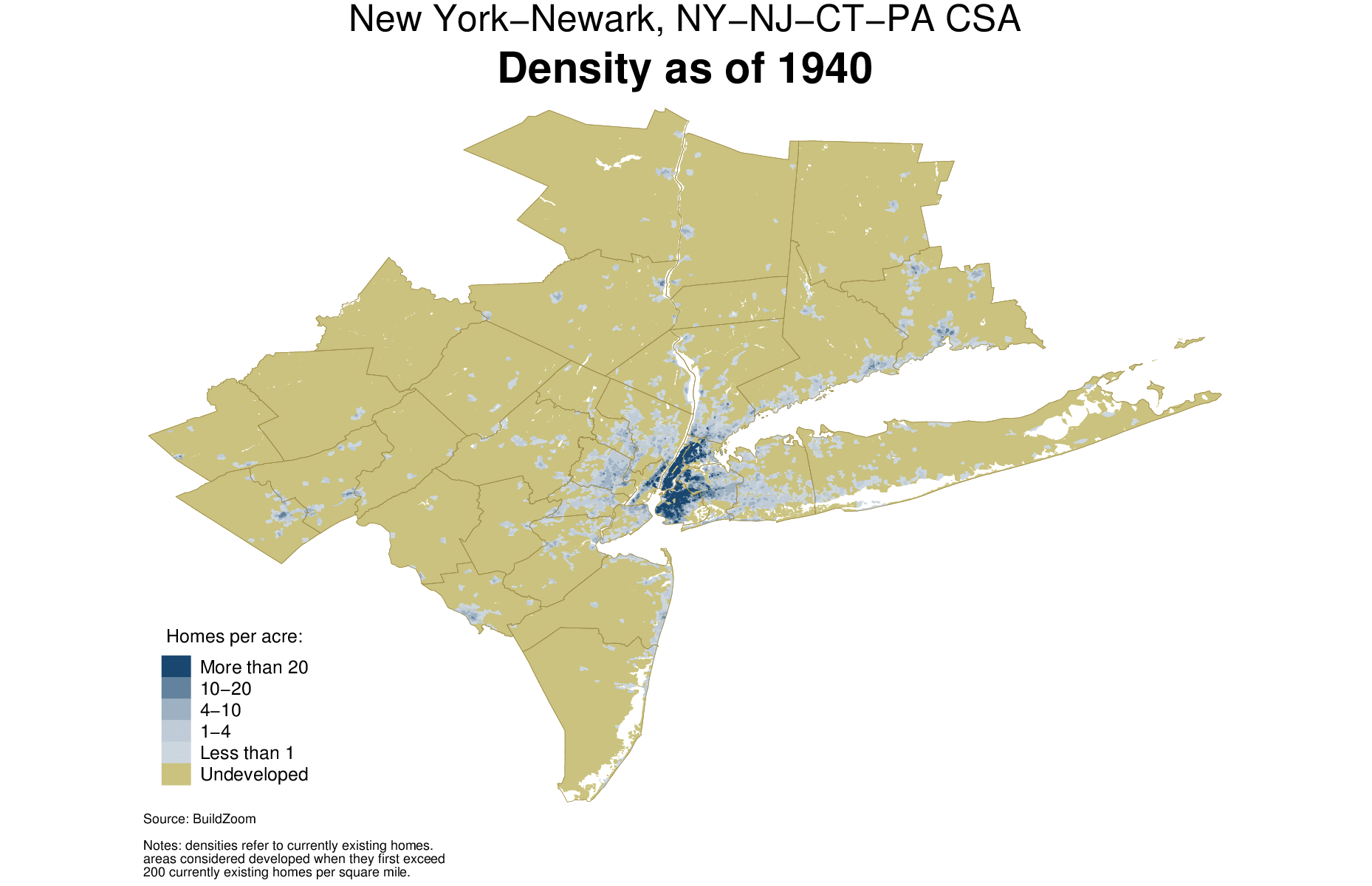

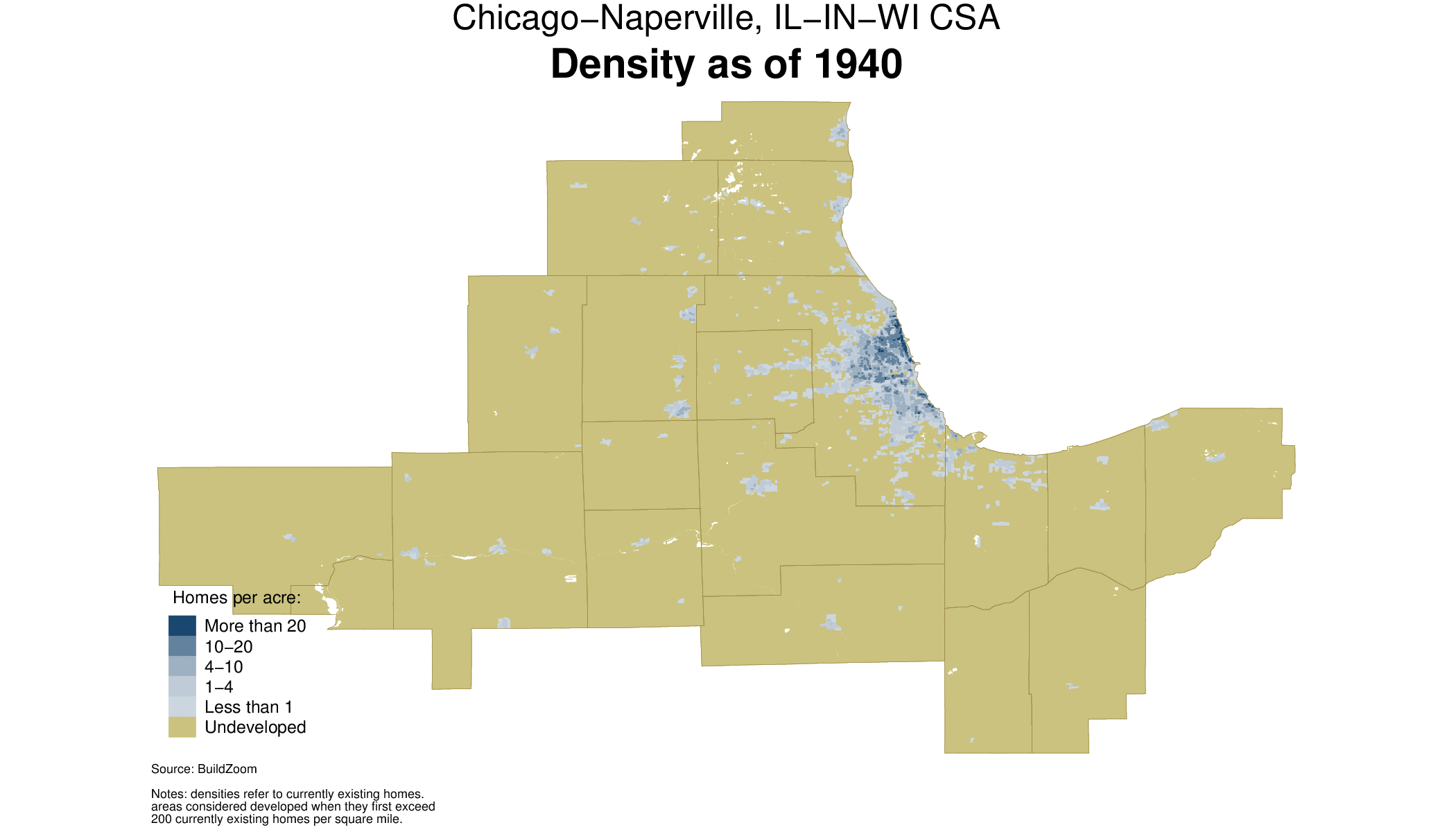
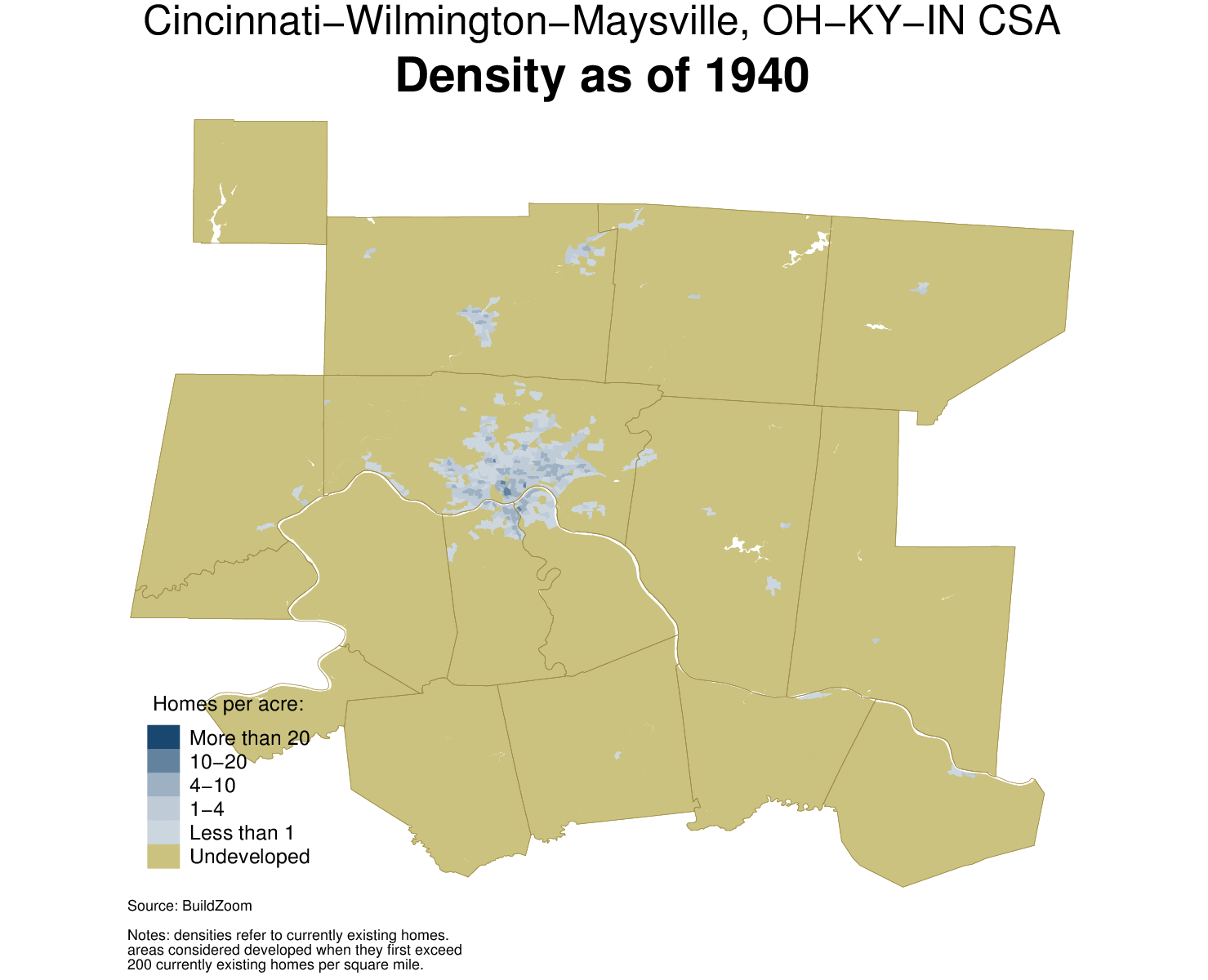
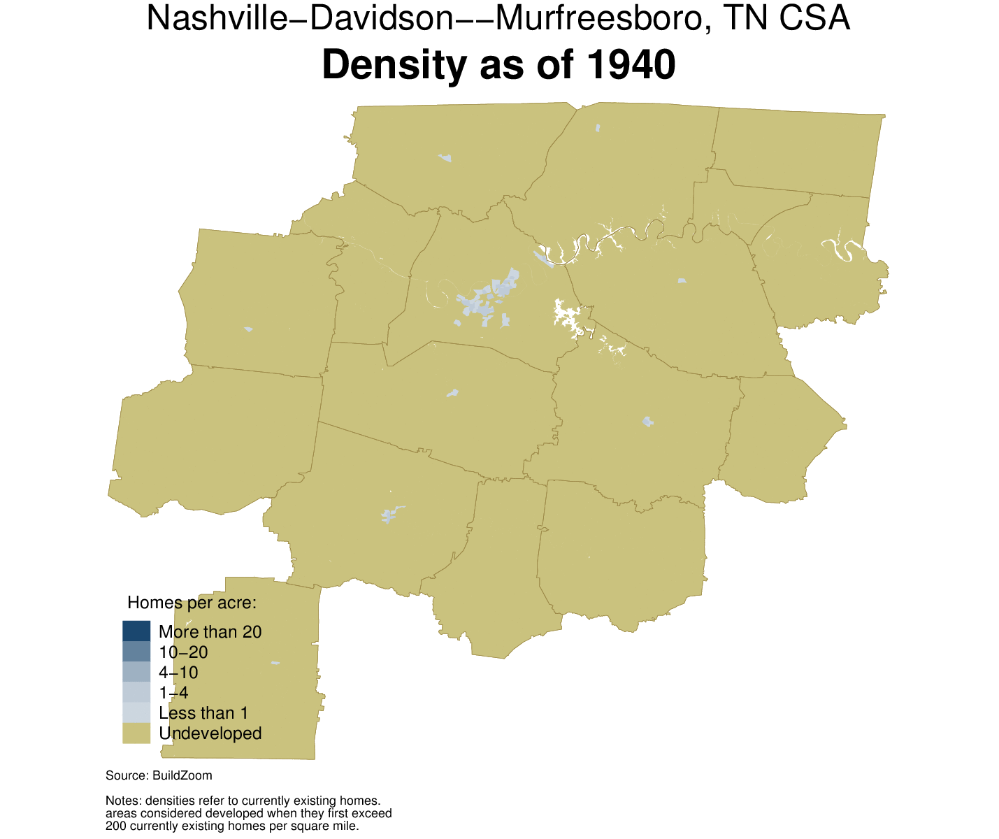
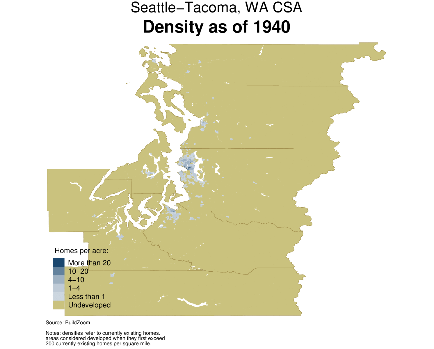
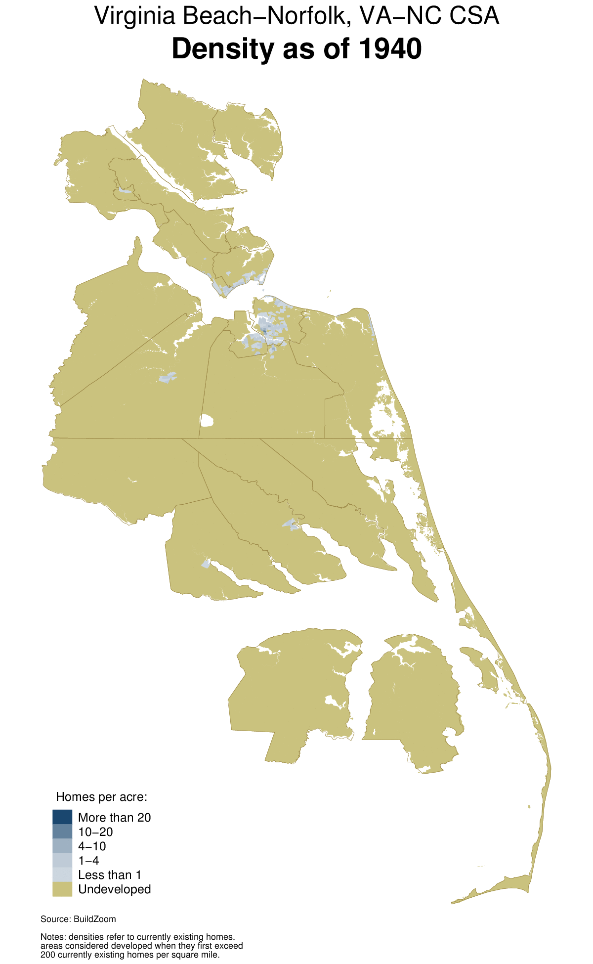
EXPANSION MAPS OF TOP 40 U.S. CITIES


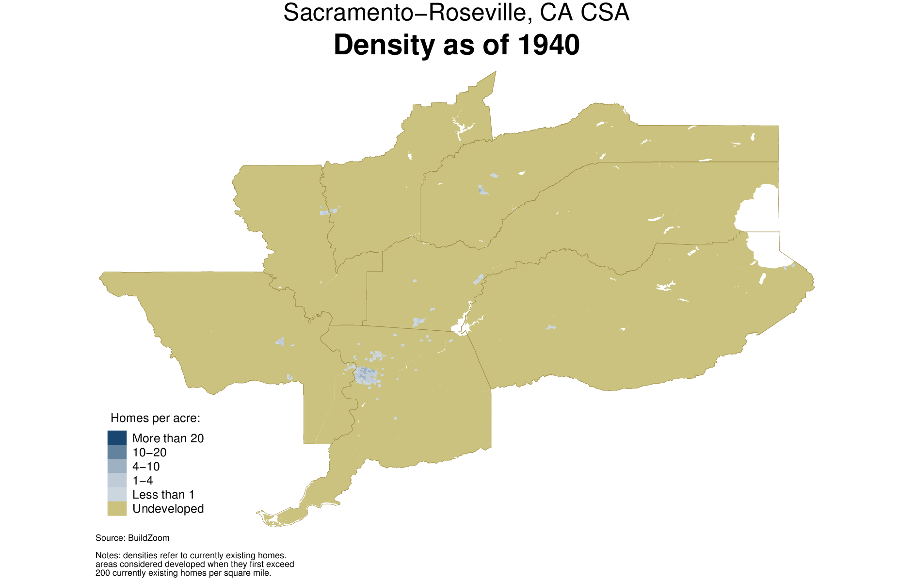


Housing production’s skew towards low density areas is important, because it is consistent with the notion that a greater inflow of undeveloped land helps cities produce more housing, through both initial development and subsequent rounds of densification. For reasons explained earlier, e.g. with respect to vacant lots, such densification is easier in low density areas. Crucially, expansive cities’ namesake outward expansion keeps low density areas more plentiful there than in expensive cities. In contrast, expensive cities have limited their inflow of undeveloped land by curbing their outward expansion, thereby choking off the initial development of new areas as well as subsequent rounds of densification. The animated density map of Tampa, below, shows how the city expanded over time, but it shows how denser areas within the city’s developed footprint expanded over time as well. The latter process visually represents the gradual rounds of densification that follow after an area is first developed.
Densification Has Slowed Down Across The Board, But Much More So In Expensive Cities
An important development of recent decades is the increasing paucity of densification. During the first post-war decades, it was fairly common for areas to grow more dense through construction on vacant lots, and in particular through the replacement of older structures with new ones containing more dwellings. The data show that densification has grown far less common over time, especially in the expensive cities.
One way of quantifying densification is asking what share of developed areas whose density was below a certain threshold at the onset crossed that threshold by the end of a period. For example, of the developed land whose density in 1950 was below 1 home per acre, the share surpassing that density during the 1950s was 42.1 percent. The left hand chart below shows that the share fell sharply after the 1950s, down to just 18.6 percent in the 2000s – less than half. The share of developed land crossing the 4 and 10 home per acre thresholds also peaked in the 1950s and then fell even more sharply, down to less than one third of its peak level by the 2000s.
Another way of quantifying densification is asking what share of areas increased their density by some fixed amount during a period. Of all the developed land as of 1950, 41.3 percent increased its density by 0.5 homes per acre or more during the 1950s. The right hand chart shows that this measure of densification, too, fell sharply after the 1950s, down to just 11.3 percent in the 2000s. Similarly, the share of developed land adding 1 or more homes per acre fell from 12.2 percent in the 1950s to 3.8 percent in the 2000s, and the share of developed land adding 2 or more homes per acre fell from 3.6 percent in the 1950s to just 0.95 percent in the 2000s.
One might be concerned that the steady reduction in this measure merely captures the fact that as the decades went by an increasing share of developed land consisted of outlying suburban areas, whose level of density – and changes thereof – tend to be smaller, but this is not the case. Repeating the exercise just within areas first developed before World War II yields similar results, as indicated by the dashed lines in the right hand chart. Interestingly, these areas exhibit an uptick in densification between the 1990s and the 2000s. The uptick tells us that the recent urban renaissance is not a myth, but that so far it has been far too limited in scale to reverse the long term trend of decreasing densification.
Aside from the slowdown in densification, the numbers also tell us that in the U.S. today, substantial densification is the exception. Just 3.8 percent of areas adding over 1 home per acre and just 0.95 percent adding over 2 homes per acre over the span of a decade is not very much, and the fraction of areas that cross the 4 and 10 home per acre thresholds each decade is also exceedingly small. In fact, the vast majority of the developed area of U.S. cities maintains a fixed level of density that doesn’t usually change much over time.


Whereas the previous two charts address the entire nation, the following chart tells us how different cities compare. For example, 57.1 percent of the developed area of New York as of 1950 added one or more homes per acre by 1980, but only 13.6 percent of its developed area as of 1980 added one or more homes per acre by 2010, which amounts to a 76.2 percent decrease in densification. The chart plots the change in cities’ pace of densification from 1980 to 2010 relative to the 1950 to 1980 period – as in the New York example – against the cities’ rate of outward expansion from 1980 to 2010. The pace of densification decreased everywhere, without exception, but the upward slope showing in the chart indicates that more expansive cities reduced their pace of densification less than others. Both legacy cities and expensive cities are clustered on the left hand side, and both groups experienced greater reductions in densification than the expansive cities on the right. Thus, in addition to the expensive cities’ lower rate of outward expansion, the greater reduction in their pace of densification helped fuel their namesake housing price growth.


Why has the pace of densification decreased? One reason is national in scope: despite some fluctuations, the total amount of new housing built each decade in the U.S. has remained fairly constant since the 1950s, but because of urban expansion the area absorbing it has grown much larger. Thus, new housing is spread more thinly, which amounts to less densification. Another way of putting it is that the demand for new housing – or growth pressure – per unit of developed land is less intense than it used to be.
Of course, growth pressure is more intense in some cities than in others. Legacy cities have seen the greatest reduction in growth pressure, so it is not surprising that their pace of densification has fallen most sharply. But both expensive and expansive cities have strong economies fueling their demand for housing, so a different reason must be found to explain why the pace of densification has fallen more in expensive cities than it has in expansive ones.
One reason has already been touched upon. By curbing their outward expansion, expensive cities have stemmed their subsequent supply of low density areas that are flush with opportunities for further development. A sizable share of densification occurs through infill – not the kind of infill for which planners reserve the term, but simply construction on vacant land scattered within developed areas. The best land is used first, and as densification progresses the remaining lots are fewer and increasingly more challenging to build on, until redevelopment ultimately becomes the only alternative. Expansive cities maintain a robust supply of fresh land that is in the early phases of the progression. In contrast, expensive cities’ reduced rate of outward expansion means that most of their land is farther along in the progression, and as a result it is getting harder for them to densify. It is no coincidence that builders today report an unprecedented shortage of vacant lots that is most pronounced in the West and the Northeast, where expensive cities cluster.
Moreover, not all low density areas are the same, and some are more likely to densify than others. Low density areas can be the product of recent decades’ outward expansion, in which case they tend to offer easy opportunities to build, but they can also be the product of residents’ opposition to development, especially if they were developed long ago and have maintained low density ever since. Opposition to development can be silent, e.g. if it is hardwired into local land use policy, it is almost never contested such as height limits or single family zoning, and it can leave little opportunity for densification.[9] The former type of low density area – ripe for further development – is bound to be more common in expansive cities, whereas the latter type of low density area – shunning development – is likely to be more common in expensive cities.
It is likely that a growing body of restrictive local land use policies has made densification harder in general (some of the policies are not land use policies per se, but building requirements that implicitly affect land use). Attention was recently drawn to the fact that 40 percent of the buildings in Manhattan could not be built legally today, and a report from the Boston suburb of Somerville – whose population is roughly 80,000 – concluded that only 22 buildings in the entire suburb meet its current zoning regulations. Restrictive land use policy can help explain why the pace of densification has decreased across the board. Inasmuch as such policy has grown even more restrictive in expensive cities than in expansive ones, it too can help explain the differential decrease in the pace of densification across these city types.
What is the path forward?
The projected growth of the U.S. population will exert growth pressure on expensive and expansive cities alike. There is infinite nuance in how cities can respond to the challenge, but essentially they must situate themselves in the space defined by three alternatives.
The first alternative is to expand with gusto. Cities that follow this path will maintain housing at more affordable levels, thereby retaining their current social character. However, going down this path will further entrench the ills associated with sprawl. Today’s expansive cities are already on this path. The expensive cities could renew their expansion, too, but it is not equally feasible for all of them to do so because some of them – particularly on the west coast – already face natural geographic boundaries that limit their potential to expand.
The second alternative is to avoid expansion, and maintain the status quo with respect to densification. Going down this path will divert population growth towards more accommodating U.S. cities (the expansive ones), and it will minimize changes to the physical character of cities and their surrounding environment. However, it will render housing increasingly unaffordable for a growing share of the population, and has already set in motion a sorting process whereby, on net, the affluent migrate into such cities while the less affluent are crowded out. In other words, it will unequivocally change the social character of these cities, while keeping their physical facade intact. Today’s expensive cities – including Seattle and Portland, despite their limited success in densifying – are on this path.[10]
The third alternative is to enact fundamental changes to land use policy that prompt far more substantial densification than any U.S. city has undergone to date. For expensive cities to increase their housing production on par with expansive ones would require a reset of land use norms. It would require cities to stop relying on vacant lots as the primary means of densification, and embrace redevelopment instead. For example, it would warrant the undoing of single family zoning through the permission and incentivization of multifamily redevelopment in areas currently reserved for single family homes. Such a change would need to be coupled with a broader acceptance of multifamily housing as a legitimate place for raising children.[11] It would also require a leap of faith that in the chicken-and-egg conundrum of density and transportation infrastructure, density can come first. This alternative will accommodate population growth, and will maintain housing affordability at a level that is more expensive than what the first alternative can achieve, but which is far more reasonable than what the second one offers.12 As a result, it will also go a long way towards maintaining the social character of the city. However, it will come at the cost of substantially altering the built environment. The facade will change.
The following diagram summarizes the tradeoffs that cities face. Of course, cities do not literally face a choice among the three alternatives. Rather, the overall impact of the land use policy enacted by all of the governing bodies in a city is equivalent to choosing a location within the triangle, representing a certain mix the of three alternatives.

Is the third alternative realistic? Many grand events and changes have come about in our lifetimes, and the introduction of substantial densification in U.S. cities could be another. The nascent YIMBY movement and the current media uproar in reaction to restrictive land use policy are both promising signs. Nevertheless, the third alternative appears unlikely at this time. The control of planning decisions in the U.S. tends to be highly dispersed, and decisions made at a more local level tend to reject development because negatively impacted stakeholders are usually concentrated nearby, whereas the beneficiaries are not. Moreover, the expensive cities’ current trajectory ultimately benefits the haves, who hold more sway than the have-nots.
If we rule out the third alternative as unrealistic, then cities confronting growth pressure face a tradeoff between accommodating growth through outward expansion, or accepting the social implications of failing to build enough new housing. Sprawl is not something to be welcomed. But people must understand that with neither outward expansion nor meaningful densification, U.S. cities cannot provide enough housing to prevent equally unwelcome changes to their social character. In the words of former Palo Alto planning and transportation commissioner Kate Vershov-Downing, “if things keep going as they are [the] streets will look just as they did decades ago, but [the] inhabitants, spirit, and sense of community will be unrecognizable.”
This study benefited from the helpful comments of Nate Clinton, Jack Cookson, Wendell Cox, Matthew Gardner, Joshua Hausman, Katie Huber, Jed Kolko, Alex Litvak, Nick Pataki, Albert Saiz and Egon Terplan. Any remaining errors are my own.
Notes:
The term “demolition bias” is a catch-all for cases in which the number of currently existing homes in an area of a given construction vintage may differ from their number in the past. In addition to demolition, homes that shifted to non-residential use in the past contribute to “demolition bias” as well. The bias can also occur in the opposite direction. For example, whereas demolition per se leads to an underestimate of the past housing stock, the conversion of an industrial structure built decades ago into loft housing would result in an overestimate of the past housing stock. On average, underestimation dominates over the 1970-2010 period in which historic data shed light on “development bias.”
The chart indicates that, on average, the percent increase in the number of homes in a city was proportional to the percent increase in the developed area of the city, but it does not indicate that all new homes were built on undeveloped land. A sizable share of new homes were built in areas that were previously developed, thereby raising the (local) density in those areas.
The 88.4 percent figure includes new homes built on undeveloped land. Among new homes built only within cities’ developed footprint, i.e. excluding undeveloped land, low density areas accounted for 84.8 percent of new homes.
Even if the threshold used to distinguish developed and undeveloped land were adjusted from its present level of 200 currently existing homes per square mile to a reasonable alternative, it would still hold true that a large share of new housing emerges from the gradual densification of low density areas.
Note that the share of homes in low density areas has slowly inched up since 1950, which means the U.S. has grown more suburban over the decades.
Looking at things the other way around, areas denser than 10 homes per acre account for a substantially greater share of existing homes than of new homes. Thus, using the same slight abuse of terminology, it can be said that housing production is skewed away from denser areas.
Of course, in reality not all else is equal. Areas whose residents more vehemently oppose development are likely to remain less dense, whereas areas whose residents are less oppositional will have grown denser, potentially generating a negative correlation between density and opposition to development.
Note that San Francisco refers to the San Jose-San Francisco-Oakland, CA CSA, which spans both the San Francisco-Oakland-Hayward, CA CBSA and the San Jose-Sunnyvale-Santa Clara, CA CBSA. Similarly, Los Angeles refers to the Los Angeles-Long Beach, CA CSA, which includes both the Los Angeles-Long Beach-Anaheim, CA CBSA and the Riverside-San Bernardino-Ontario, CA CBSA.
When resistance to densification is hardwired into local land use policy, e.g. through single family zoning, one will be hard pressed to find evidence of disrupted development, because no developer would attempt it. Building condo towers in Palo Alto, for example, would be a highly lucrative undertaking, but no developer would apply for permission to build them because there is (presently) no hope of approval.
Improving cities’ transportation infrastructure is unlikely to solve cities housing affordability challenges without expanding their developed footprint. It can help reduce housing costs by allowing better access to the high demand areas from less expensive ones, thereby dulling housing price peaks on the city map, but its capacity to increase the housing supply will be limited by these areas’ ability to grow denser. On the other hand, if the new transportation infrastructure connects undeveloped areas to the city, or functionally tethers existing nearby cities to it, then such infrastructure amounts to a catalyst for expansion.
Shifting from single family to multifamily housing involves a sacrifice in terms of living standards. The current wave of interest in micro-units takes the sacrifice of living standards to an extreme.
The third alternative will maintain housing prices near construction costs, but these costs are higher when development is denser, and even more so when it involves redevelopment. Cities would do well to streamline the redevelopment process, both procedurally and otherwise. For example, one could imagine a service allowing property owners to signal their willingness to sell to developers engaged in redevelopment, thereby easing the frictions associated with lot assembly.
Methodology:
Definition of cities: cities in the study are defined using current White House Office of Management and Budget (OMB) definitions for Combined Statistical Areas (CSAs) and Core-Based Statistical Areas (CBSAs). CBSAs are defined along county lines and each CBSA consists of one or more counties. CSAs are clusters of contiguous CBSAs, so every CSAs consists of multiple constituent CBSAs, e.g. the San Francisco-Oakland-Hayward, CA CBSA and the San Jose-Sunnyvale-Santa Clara, CA CBSA jointly comprise the San Jose-San Francisco-Oakland, CA CSA. However, some CBSAs do not fall within a CSA, e.g. the San Diego-Carlsbad, CA CBSA. The cities in this study consist of all CSAs and, in addition, all CBSAs that do not fall within a CSA (the latter include both metropolitan and micropolitan statistical areas).
Determination of an area’s housing density over time: areas’ housing densities each decade are determined at the Census block-group level. Data on the estimated number of currently existing housing units in each block group, broken down by decade built, is obtained from the 2010-2014 5-year American Community Survey (ACS) summary files. Data on the land area of each block group is obtained from the 2014 Census TIGER shapefiles. The cumulative number of existing housing units built in a block group until a given decade is divided by the block group’s land area to obtain an estimate of its housing density as of that decade. Note that housing density does not reflect non-residential structures, i.e. if an area contains non-residential structures it may be more densely developed than housing density alone would suggest. Housing density estimates are likely to be biased for two reasons:
Demolition bias: housing density estimates reflect only currently existing housing units, i.e. dwellings that were observed in the 2010-2014 5-year ACS. The construction of housing units that were later demolished – prior to observation in 2010-2014 – is not reflected in the data. Housing units built as part of subsequent redevelopment, and which were still in place as of the 2010-2014 5-year ACS, are reflected in the data. For example, suppose 10 housing units were built on a 10 acre block group in 1965, and then demolished in 1985 and replaced by 20 new housing units. The block group will be recorded as having a housing density of zero homes per acre through the 1980 observation, as having an increase of 2 homes per acre during the 1980s, and as having a housing density of 2 homes per acre from the 1990 observation on. More generally, the term “demolition bias” is a catch-all for cases in which the number of currently existing homes of a given construction vintage in an area may differ from their number in the past. In addition to demolition, homes that shifted to non-residential use in the past contribute to “demolition bias” as well. The bias can also occur in the opposite direction. For example, whereas demolition per se leads to an underestimate of the past housing stock, the conversion of an industrial structure built decades ago into loft housing would result in an overestimate of the past housing stock. On average, underestimation dominates over the 1970-2010 period in which historic data shed light on “development bias.” See “accounting for demolition bias” below.
Granularity bias: areas whose current housing density is low are likely to be carved up by the Census into larger – less granular – plots of land, and are therefore more likely to include some rural territory that lowers their calculated density. Block groups near the urban-rural fringe are likely to be less densely populated, and are therefore more likely to include rural territory that artificially lowers their observed density.
Determination of an area’s vintage: the decade in which an area was first developed, referred to as the area’s vintage, is determined at the Census block group level, as the decade in which the density of currently existing housing units first exceeds 200 units per square mile.
Estimation of cities’ land area over time: a city’s land area as of a given decade is determined by summing the area of its constituent Census blocks – not block groups – when they satisfy two conditions. First, their vintage must be equal to or older than the given decade. Second, the blocks must be defined by the Census as part of an urban area, as per the Census’ current definition of urban areas. A brief description of the current definition is available here, and comprehensive details are available here. As a result, in block groups containing a mixture of urban and rural blocks, only the land area of the urban blocks counts towards the city’s area. The definition of urban areas involves subjective judgment and has varied substantially over time. As a result, an alternative estimate of cities’ areas obtained as the sum of (one or more) whole constituent urban areas would be subject to inconsistent definitions across time periods, whose effect would be difficult to distinguish from actual changes in area.
Mapping: mapping is performed at the Census block level, using 2014 Census TIGER shapefiles. In block groups containing a mixture of urban and rural blocks, only the land area of the urban blocks is mapped as developed and as falling into a particular housing density bin as of the decade corresponding to the block group’s vintage.
Population: each city’s population as of a given decade is taken as the sum of its constituent counties’ populations. Thus, the population and changes thereof include people living in the rural portion of the counties comprising each city. County population estimates for 1940 through 1990 were obtained from a National Bureau of Economic Research (NBER) compilation, available here, and for 2000 and 2010 from the Census’ American FactFinder.
Housing price growth: housing price growth is derived from quarterly, non-seasonally adjusted Federal Housing Finance Agency (FHFA) housing price indices for all transactions, available via the St. Louis Federal Reserve’s FRED portal. The indices were adjusted for inflation using the consumer price index for all urban consumers and for all items less shelter, also obtained from the portal. The indices are available from 1975 onwards. To obtain a long-run view of housing prices that is not overly driven by transitory factors, e.g. the extent of fluctuation during the 2000s boom and bust, housing price growth is taken as the percent change in the ten year average of the inflation-adjusted indices during the decade from 2005 to 2014 and similarly during the decade from 1975 to 1984. The FHFA indices are available for CBSAs, but not for CSAs. For each CSA, the study uses the CBSA-level index for the “main” CBSA, as indicated by the informal name used to refer to the CSA in the study. For example, the housing price index used for San Francisco, i.e. the San Jose-San Francisco-Oakland, CA CSA, is the housing price index for the San Francisco-Oakland-Hayward, CA CBSA, as indicated by the informal reference to the CSA as San Francisco, rather than San Jose. The substitution of a CBSA-level index for a CSA-level one is an approximation.
Accounting for demolition bias: the extent of demolition bias is assessed, and accounted for where possible, in the following steps.
Contemporaneous data on the number of homes at the county level, broken down by year structure built, is obtained from the 1970-2010 decennial Censuses (such data, even without the breakdown, is not available at the county level for 1950 and 1960). The source: Minnesota Population Center. National Historical Geographic Information System: Version 2.0. Minneapolis, MN: University of Minnesota 2011.
The contemporaneous data is used to construct the observed number of housing units in each county and decade, by structures’ construction vintage decade, e.g. the number of homes in Ventura County, CA, observed in the 1980 Census as being in structures built during the 1950s is recorded. These numbers are summed at the city level, i.e. at the appropriate CBSA or CSA level (see above).
The number of homes observed in each city prior to 2010 using the 2010-2014 5-year ACS – as opposed to the contemporaneous data – is then adjusted using the appropriate the contemporaneous data. For example, suppose the number of homes observed in the Los Angeles-Long Beach, CA CSA in structures built prior to 1980 decreased by 10 percent between the contemporaneous 1980 and 2010 observations (obtained in step b). In this case, the number of currently existing homes observed in the 2010-2014 5-year ACS as having been built before 1980 will be divided by 0.9 = 1 – 0.1 to adjust for the decrease observed in the contemporaneous data.
Note that in the contemporaneous data, areas that fall within or outside the city’s developed footprint cannot be distinguished, because the geographic granularity of the contemporaneous data is not as fine as the 2010-2014 5-year ACS data. Thus, the adjustment for demolition bias reflects contemporaneous observations of all housing in the city’s constituent counties, including those in undeveloped areas.
The adjustment for demolition bias can be applied to the number of homes in a city from 1970 onwards, as well as changes thereof. Because appropriate contemporaneous data is not available before 1970, the adjustment cannot be applied to any measure that spans earlier years, e.g. the period 1950-1980. Furthermore, the limited geographic granularity of the contemporaneous data limits the scope for adjusting measures of local density, including estimates of cities’ area which rely on density.